Nearest Fly Shop: Little River Outfitters – Townsend
Camping:
Little River Campground Cades Cove Campground Backcountry Campsite #17
Directions:
From Townsend, travel southeast on 73 to GSMNP
entrance. At the “Y” in the road, turn
right on Laurel Creek Road (toward Cades Cove).
You will immediately pick up the stream on the right and find a few
pull-offs where you can access the stream.
At approximately two miles, the road ceases to follow the stream. There is a parking area at this point where
you can access the backcountry portion of West Prong, but there is no trail so
you will have to return through the stream.
A trail does intersect
the stream approximately two miles up from the road. This is the West Prong Trail and can be
accessed directly across the road from the Tremont Institute. Again, the trail does not follow the stream
at any point but will grant you access to the upper reaches of West Prong at
their intersection at Backcountry Campsite #17.
To reach the trailhead, travel southeast from Townsend on 73 and turn
right at the “Y” on Laurel Creek Road.
Take your first left toward the Tremont Institute. The Tremont Institute is approximately two
miles back on your left, and the trailhead is at the parking area on the right,
across the road from Tremont.
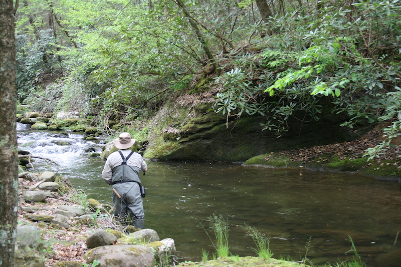
September was a tough month. Our rainfall totals for the month were a micro-notch above zero, and it was one of the warmest Septembers on record. Guide trips went surprisingly well for the most part. For folks willing and able to hike 2-3 miles in, the fishing was pretty productive. For those limited to roadside destinations, things were quite a bit slower.
October will definitely start right where September left off. We should see 90’s for the first week but looks like things may begin easing into fall-like temperature after the first weekend. But if history is any guide, stream levels won’t see any improvement. Most years, we don’t begin seeing significant rainfall again until November.
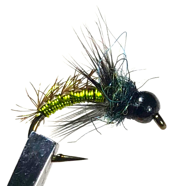
So plan on being stealthy. Plan on longer tippets. Plan on smaller flies. They’re going to be a challenge! Fly patterns with orange, tan or rust coloring are always a good bet in the fall. We also tend to see more caddis this time of year, so caddis specific patterns or any generic down-wing pattern like a Stimulator should be a good choice.
Clinch
The Clinch is showing signs of improvement. Weekend flows have been pretty good for wading and weekdays are starting to get more consistent. Of course, that’s always subject to change at a moments notice! As usual, midges are the main course.
We had a better than usual August in the Smokies. Fairly regular rainfall kept water levels respectable and other than a few spells, it was relatively mild. Streams are beginning to get low again though and September is typically a very dry month here unless we pick up some hurricane remnants. The current beast, Dorian, is not showing signs of tracking this direction, so prepare yourself for low water and spooky fish.
I would expect to see mostly warm, summer type conditions for the first half of the month with a gradual cooling toward the middle of the month. There aren’t many hatches to speak of in September. Caddis are always a good possibility and Isonychias are active, but that’s more important as a nymph. Terrestrials are still probably the main course for the next month or so.
Clinch River
The Clinch has been a tough one this year. Flows have not been very friendly to the wade fisherman, at least with any predictability. If you live nearby and have a flexible work schedule, you’ve probably found some mornings to fish. Hopefully, we’ll see some more consistency in September.
If so, you’ll likely see better water in the morning and early
afternoon. Don’t expect to see much in the way of hatches except for
midges. I’d tie on a dark Zebra Midge as small as you dare to go!
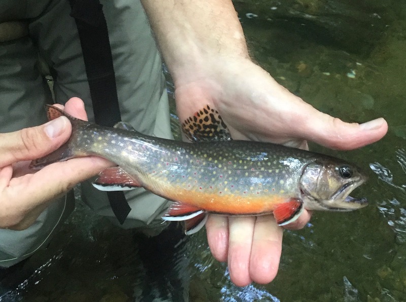
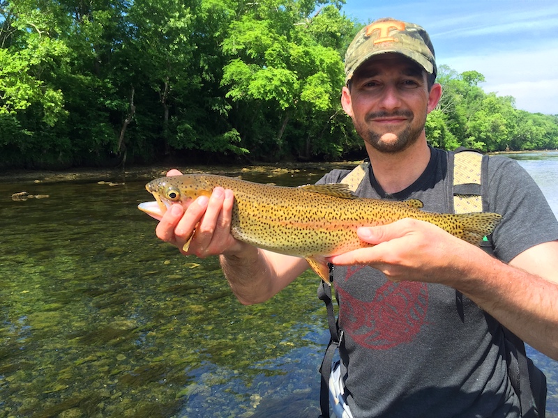
Species: Rainbow
trout (maybe a very rare brown or brook trout)
Average Size:
6-8”
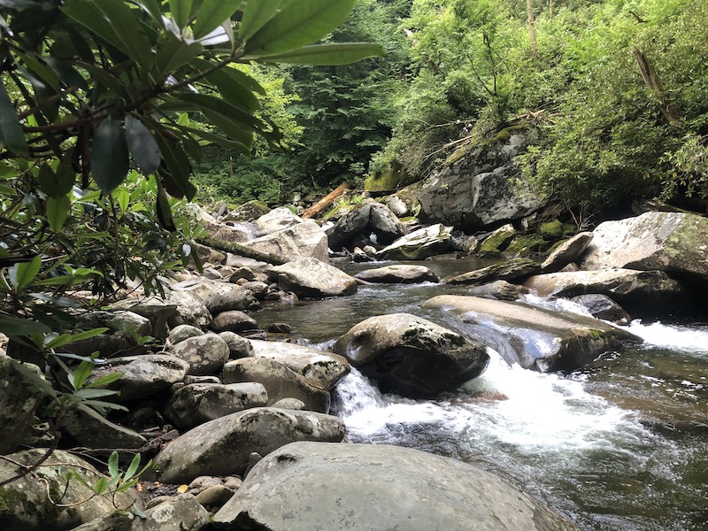
Stream Size: Moderate
Pressure: Light
Type of Water:
Freestone, Mountain
Boat Access: None
Best Times:
Spring through late fall
Favorite Flies:
Attractor dries
Nearest Fly Shop: Little River Outfitter – Townsend
Directions:
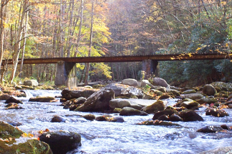
From Townsend, travel southeast on 73 to GSMNP entrance. At the “Y” in the road, turn right on Laurel Creek Road (toward Cades Cove). Take your first left (toward Tremont Institute). This road will follow the Middle Prong of Little River for approximately five miles. The first two miles (to Tremont) are paved and the three miles above Tremont are gravel. The road comes to an end at a large parking area, located where Lynn Camp Prong and Thunderhead Prong converge to form the Middle Prong of Little River. From the parking area, cross the bridge and take the trail on the right. It is unmarked and does not appear on maps, but remains fairly clear due to frequent foot traffic.
The trail follows Thunderhead for probably a mile or better, just beyond where Sam’s Creek enters the stream, before coming to an abrupt halt. From this point you will have to make your way through the stream and by bank when available. Of course you will have to return the same way. All and all, there is probably a little more than four miles of Thunderhead to be fished.
We had a pretty good July in the Smokies. As one would expect, most of the productive fishing was in the higher elevations. Most of my time was spent in the backcountry, and for those willing to walk a ways, fishing was usually good! A big rain system dumped a ton of water on us the weekend of the 20th and we had to cancel a few trips, but a wonderful cool front followed and brought very mild temperatures for a few days.
August should mirror July but likely without the rainfall. August is usually dryer and probably a little hotter on average. Again, expect more activity up high and on smaller streams. Terrestrials are still the main fare for trout flies.
Clinch River
We saw a little bit of good water on the Clinch in July but not much. This year’s rainfall has kept the dam churning. We have, however, seen a recent change in that trend and are beginning to get better flows. Hopefully that will continue into August.
If so, you’ll likely see better water in the morning and early afternoon. Don’t expect to see much in the way of hatches except for midges. I’d tie on a dark Zebra Midge as small as you dare to go!
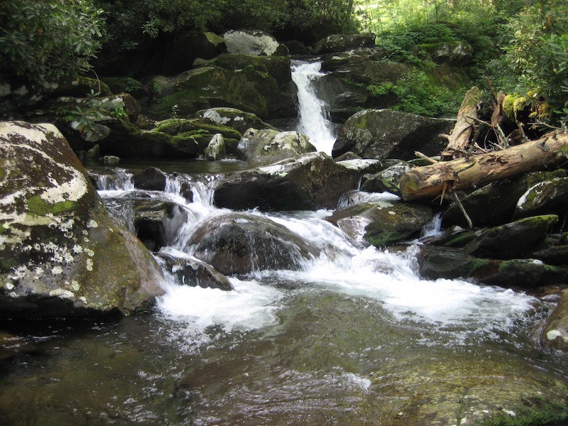
Abrams Creek is one of the best known trout streams in the national park if not the southeast. While its reputation is probably based more on how well it used to fish, it is still a top quality fishery and a very worthy destination.
Once a prolific brown trout fishery, Abrams consists
primarily of rainbows these days. Though
nobody seems too certain of the reason for the decline in brown trout, comfort
is taken in the quality of rainbows that make this stream home. Abundant food and a slower flow of water
likely account for these larger than average rainbows. However, with rainbows up to 18” in length a
possibility, an 8” to 10” fish is more the norm.
There is really no road access to this stream but a trail follows it through the majority of the best trout water, which is located between Cades Cove and the Abrams Creek Campground. The stream actually originates above the cove from Anthony Creek. However, it is difficult to distinguish where Anthony Creek ends and where Abrams Creek begins. As a matter of fact, it is difficult to follow Abrams Creek at all as it flows through the pastures of Cades Cove due its temporary disappearance underground and reappearance in the form of springs.
In Cades Cove
It maintains this smaller spring creek characteristic throughout its journey through the cove and is difficult to reach with no road access. Furthermore, there is no trail through this stretch, and the terrain through Cades Cove is much rougher than you’d think! Cades Cove consists of an eleven mile, one lane driving loop that encircles the cove and grants tourists access to historic structures and viewable wildlife, all from the comfort of their automobile. During peak seasons, it can take up to three hours to drive around the loop with the always possible “bear jam” capable of shutting down traffic completely.
While there is no road that follows the stream through the cove, there are two roads that cut across the loop, Sparks Lane and Hyatt Lane. Both of these roads cross Abrams Creek. Sparks Lane is the first one you will encounter and will allow the quickest access. To reach it, enter the loop and drive .09 miles and it will be on your left. It will cross Abrams approximately .08 miles back. After fishing, you can exit by continuing on Sparks Lane to the other end and turning left, back onto the loop.
From this point you will only have about a mile and a half of the loop to travel before exiting. The second option is Hyatt Lane. To reach it, enter the loop and it will be 2.8 miles back on your left. Hyatt Lane crosses the stream about a mile back. As with Sparks Lane, you can exit by continuing back Hyatt to its end and turning left on the loop. From there you will have an approximate 3 mile drive before exiting the loop.
The “Cove Section”
All of the water in the cove is relatively small and relatively slow moving. As a result, the fish can be extremely spooky. The best time to fish this stretch is typically after a decent rain when the water is a little high and slightly off color. I also tend to focus on early season to fish this stretch when water temps are lower and traffic in the cove is at a minimum. Winter fishing in the park is generally not fantastic but if you do decide to try your luck in January or February, this would probably be one of your better bets.
Above the Falls
After flowing out of the cove, the stream passes by a large
parking area, also accessible via the loop road, and begins its approximate 15
mile tumble to Chilhowee Lake, with about half of that distance paralleled by
trail. There are two practical ways to
access this section of trail. The first
is via the loop road.
Upon entering the loop, drive 4.8 miles and turn right at
the sign indicating the Abrams Falls Trail.
After turning, drive another half mile and there will be a large parking
area. At this point you can actually
fish upstream a pretty good ways, accessing the last of the “meadow
water.” There is not trail access but you’ll
see many well-beaten fisherman’s paths.
You can also access Abram’s Falls Trail here, which will lead you
downstream.
Although this trail parallels the stream for most of the
way, there are several stretches where it is high above the water or there is
enough thick growth to prevent access.
So you may have to do a little scouting to plan your way in and out of
the stream. When doing so, beware of the
shoe!
The Infamous Horseshoe
One of the most notorious stretches of Abrams Creek is the horseshoe. When hiking the trail, you lose site of the stream for a short time, crest a ridge, and soon see the stream again. To the casual observer it might appear that you could hop in at one point and easily fish your way to the other, when in fact, the stream flows a considerable distance away from the trail, forming a horseshoe shape. This horseshoe of water is about a mile and a half long and requires a full day to fish. Furthermore, you have to fish pretty quickly. Failure to recognize this could result, as it has for many, in a feeble attempt to bushwhack back to the trail and ultimately spending the night there.
Fishing the Horseshoe
The horseshoe can be a great, remote stretch of water to fish. Just go in there properly prepared and plan to spend the day – a LONG day. Get an early start, pack a lunch, and take a buddy. If something happens, you’ll be very hard to find! I also recommend taking a handheld GPS if you have one. This allows you to track your progress through the stretch and can let you know if you need to pick up the pace.
Continuing down the trail, there is another similar stretch
of water just above Abrams Falls referred to as the “little shoe” or “baby
shoe.” It provides the same scenario as
the horseshoe, only it is shorter in length.
At least a half day should be dedicated to this stretch and the same
precautions should be taken.
Below the Falls
The trail continues past Abrams Falls and then requires a
short detour on Hatcher Mountain Trail and another change to Little Bottoms
Trail to stay with the stream. Little
Bottoms Trail, like Abrams Falls Trail, will parallel Abrams Creek but offers
only select locations to get in and out.
Ultimately, Little Bottoms Trail joins Cane Creek Trail and delivers you
to the Abrams Creek Campground. Since
you can reach this campground by automobile, driving to it and hiking up the
trail make the most sense to access the stretch of Abrams below the falls.
To reach Abrams Creek Campground, travel south on 129 and
turn left just past Foothills Parkway onto Happy Valley Road. Drive 5.8 miles back and turn right at the
sign for Abrams Creek Campground. About
a mile back, you will find a place to park just before entering the
campground. The campground will allow
you access to a little more of Abrams Creek before you get on the trail.
Lower Abrams
Below the campground, Abrams Creek is very difficult to access and much of it is too deep to wade. Because of this,the best way to fish this portion of the creek is to take a canoe up from the mouth of Abrams Creek – where it enters Chilhowee Lake. I’ve also seen fishermen in float tubes on this stretch.
While this lower stretch does get runs of trout from
Chilhowee, particularly in the early part of the year, it is primarily home to
smallmouth bass. The smallies grow to
better than average sizes here and while they will take the occasional top
water bug, they’ll much more likely fall victim to streamers and large
nymphs.
From the campground to the falls, you’ll find a mix of
rainbows and smallmouth with the percentage of rainbows steadily increasing the
further up you go. From the falls up, it
is almost entirely rainbows and it is this stretch, from the falls to the cove
that I would deem the most consistently productive trout water on Abrams Creek.
Recommendations and Tips
When fishing this stretch, felt soles are a must if you want to stay upright. And even with felt there are no guarantees. With its long sloped rocks and silty bottom, this is without a doubt the slickest stream I’ve ever waded.
Soft Hackle Wired Caddis
You’ll do much better here in spring and fall. Furthermore, all of the standard Smoky Mountain fly patterns should serve you well here. Just make sure your fly box includes a selection of caddis in #18 – #14 range as hatches can be prolific.
Best Times:
Spring through late fall, after a good rain
Favorite Flies:
Attractor dries
Nearest Fly Shop: Little River Outfitters – Townsend
Camping: Elkmont Campground
Backcountry
Campsite #27
Directions:
From Townsend, travel southeast on 73 to GSMNP
entrance. At the “Y” in the road, turn
left toward Gatlinburg on Little River Road.
Follow approximately twelve and a half miles and turn right toward
Elkmont Campground. Or, from Townsend,
turn on Wears Valley road at the only traffic light in town. At about six and a half miles, turn right on
Lyon Springs Road. This road will
eventually end at Little River Road at Metcalf Bottoms picnic area. Turn left and follow for about four and a
half miles and turn right toward Elkmont Campground. Upon reaching the campground entrance, turn
left toward Little River Trailhead and follow past the Little River Trailhead.
You’ll enter a short, one lane loop that will take you to the parking area for
the Elkmont Historic District. You can access the lower part of the creek here,
or walk up the gated gravel road that leads to the Jakes Creek Trailhead. This
small piece of road will provide access to another portion of Jakes Creek and
the trail will provide access to another three miles of stream, as well as
Backcountry Campsite # 27. Be aware,
however, that much of this trail is high above the streambed with only a few
locations allowing reasonable access to the stream. The best bet is to identify these locations
and fish from access point to access point.
From Gatlinburg, travel southwest on 73/321 and merge south
onto 441/71 toward Cherokee, NC. Just
past the Sugarlands Visitor Center, turn right toward Townsend on Little River
Road and follow approximately four and a half miles. Soon after passing Laurel Falls trailhead,
turn left toward Elkmont Campground. Upon reaching the campground entrance,
turn left toward Little River Trailhead and follow past the Little River
Trailhead. You’ll enter a short, one lane loop that will take you to the
parking area for the Elkmont Historic District. You can access the lower part
of the creek here, or walk up the gated gravel road that leads to the Jakes
Creek Trailhead. This small piece of road will provide access to another
portion of Jakes Creek and the trail will provide access to another three miles
of stream, as well as Backcountry Campsite # 27. Be aware, however, that much of this trail is
high above the streambed with only a few locations allowing reasonable access
to the stream. The best bet is to
identify these locations and fish from access point to access point.
Nearest Fly Shop: Little River Outfitters – Townsend
Lodging: Talley Ho
Docks
Camping: Elkmont Campground
Little
River Campground
Backcountry
Campsites #24 & #30
Directions:
From Townsend, travel southeast on 73 to GSMNP
entrance. At the “Y” in the road, turn
left toward Gatlinburg on Little River Road.
Follow approximately twelve and a half miles and turn right toward
Elkmont Campground. Or, from Townsend,
turn on Wears Valley road at the only traffic light in town. At about six and a half miles, turn right on
Lyon Springs Road. This road will
eventually end at Little River Road at Metcalf Bottoms picnic area. Turn left and follow for about four and a
half miles and turn right toward Elkmont Campground. Upon reaching the campground entrance, turn
left toward Little River Trailhead and follow to the parking area at the end of
the road.
From Gatlinburg, travel southwest on 73/321 and merge south
onto 441/71 toward Cherokee, NC. Just
past the Sugarlands Visitor Center, turn right toward Townsend on Little River
Road and follow approximately four and a half miles. Soon after passing Laurel Falls trailhead,
turn left toward Elkmont Campground.
Upon reaching the campground entrance, turn left toward Little River
Trailhead and follow to the parking area at the end of the road.
The trail follows Little River for about six miles providing
frequent river access along the way. The
further up the trail you go, the smaller the stream will become and the fewer
people you will see. Backcountry
Campsite #24 is about four miles up the trail, and Backcountry Campsite #30 is
located near the trail’s end at six miles.
A visit to Backcountry Campsite will also put you in close proximity to Rough Creek and Fish Camp
Prong.
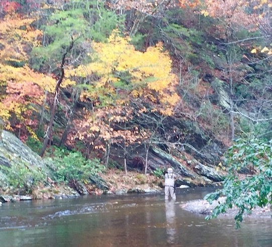
May is traditionally a great month to fish in the Smokies and this year should be no different. With the mild temperatures seen in May, you have pretty much every option on the table, from low elevation roadside rivers to high elevation backcountry streams.
Hatches are usually at their best this time of year, too. During the day, you should see mayflies like March Browns and Light Cahills, a number of different caddis species, and the most prolific hatch in the Smokies, the Little Yellow Sally shtonefly. Toward the end of the month, you should also see some of the larger golden stones hatching. They are often seen in sizes #8-#6 but mostly hatch at night. However, trout are often still looking for them after sunrise, so a big dry fly like a Madame X can be a good bet in the mornings.
Speaking of nighttime hatches. The month of May often showcases some of the most consistent hatches of the year right before dark. From about 7pm until dark, look for hatches of sulphur mayflies coinciding with egg-laying Little Yellow Sallies.
Clinch River
As usual, the Clinch River is anyone’s guess as far as water releases. We had some very favorable generation schedules through much of April and the fish was great. In recent days, they’ve been pushing quite a bit more water, leaving a much smaller window for the wade fisherman.
Typically, May is the month when the sulphur hatch really gets underway on the Clinch. We’ve seen a few popping off in recent weeks. When this hatch is in full swing, it’s really something to see. Hopefully the water releases will cooperate!
Otherwise, it’s the usual suspects on the Clinch. Beadhead Pheasant Tails and a variety of colors of Zebra Midges should do the trick.