West Prong Little River

west prong little river
West Prong Little River

Location: GSMNP East Tennessee                          

Nearest Town: Townsend, TN

Species: Rainbow trout                                            

Average Size: 6”

Stream Size: Moderate                                           

Pressure: Moderate

Type of Water: Freestone, Mountain                      

Boat Access: None

Best Times: Spring and fall                                      

Favorite Flies: Attractor dries

Nearest Fly Shop:    Little River Outfitters – Townsend

Camping:      

Little River Campground
Cades Cove Campground
Backcountry Campsite #17

Directions: 

From Townsend, travel southeast on 73 to GSMNP entrance.  At the “Y” in the road, turn right on Laurel Creek Road (toward Cades Cove).  You will immediately pick up the stream on the right and find a few pull-offs where you can access the stream.  At approximately two miles, the road ceases to follow the stream.  There is a parking area at this point where you can access the backcountry portion of West Prong, but there is no trail so you will have to return through the stream. 

A trail does intersect the stream approximately two miles up from the road.  This is the West Prong Trail and can be accessed directly across the road from the Tremont Institute.  Again, the trail does not follow the stream at any point but will grant you access to the upper reaches of West Prong at their intersection at Backcountry Campsite #17.  To reach the trailhead, travel southeast from Townsend on 73 and turn right at the “Y” on Laurel Creek Road.  Take your first left toward the Tremont Institute.  The Tremont Institute is approximately two miles back on your left, and the trailhead is at the parking area on the right, across the road from Tremont. 


October Fishing Forecast

fall fishing on little river
Fall Fishing on Little River

Smokies

September was a tough month. Our rainfall totals for the month were a micro-notch above zero, and it was one of the warmest Septembers on record. Guide trips went surprisingly well for the most part. For folks willing and able to hike 2-3 miles in, the fishing was pretty productive. For those limited to roadside destinations, things were quite a bit slower.

October will definitely start right where September left off. We should see 90’s for the first week but looks like things may begin easing into fall-like temperature after the first weekend. But if history is any guide, stream levels won’t see any improvement. Most years, we don’t begin seeing significant rainfall again until November.

So plan on being stealthy. Plan on longer tippets. Plan on smaller flies. They’re going to be a challenge! Fly patterns with orange, tan or rust coloring are always a good bet in the fall. We also tend to see more caddis this time of year, so caddis specific patterns or any generic down-wing pattern like a Stimulator should be a good choice.

Clinch

The Clinch is showing signs of improvement. Weekend flows have been pretty good for wading and weekdays are starting to get more consistent. Of course, that’s always subject to change at a moments notice! As usual, midges are the main course.

September Fishing Forecast

Smoky Mountain Brook Trout
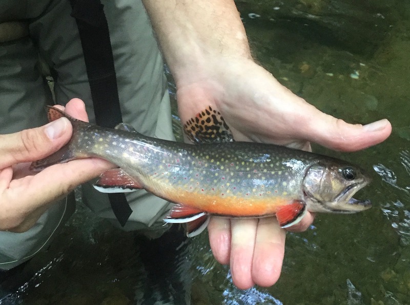
A nice highcountry brook trout

Smoky Mountains

We had a better than usual August in the Smokies. Fairly regular rainfall kept water levels respectable and other than a few spells, it was relatively mild. Streams are beginning to get low again though and September is typically a very dry month here unless we pick up some hurricane remnants. The current beast, Dorian, is not showing signs of tracking this direction, so prepare yourself for low water and spooky fish.

I would expect to see mostly warm, summer type conditions for the first half of the month with a gradual cooling toward the middle of the month. There aren’t many hatches to speak of in September. Caddis are always a good possibility and Isonychias are active, but that’s more important as a nymph. Terrestrials are still probably the main course for the next month or so.

Clinch River

The Clinch has been a tough one this year. Flows have not been very friendly to the wade fisherman, at least with any predictability. If you live nearby and have a flexible work schedule, you’ve probably found some mornings to fish. Hopefully, we’ll see some more consistency in September.

If so, you’ll likely see better water in the morning and early afternoon. Don’t expect to see much in the way of hatches except for midges. I’d tie on a dark Zebra Midge as small as you dare to go!

Thunderhead Prong

Location: GSMNP East Tennessee                                                              

Nearest Town: Townsend, TN

Species: Rainbow trout (maybe a very rare brown or brook trout)                                     

Average Size: 6-8”

Stream Size: Moderate                                           

Pressure: Light

Type of Water: Freestone, Mountain                                                          

Boat Access: None

Best Times: Spring through late fall                                                             

Favorite Flies: Attractor dries

Nearest Fly Shop:    Little River Outfitter – Townsend                                                    

Directions: 

From Townsend, travel southeast on 73 to GSMNP entrance.  At the “Y” in the road, turn right on Laurel Creek Road (toward Cades Cove).  Take your first left (toward Tremont Institute).  This road will follow the Middle Prong of Little River for approximately five miles.  The first two miles (to Tremont) are paved and the three miles above Tremont are gravel.  The road comes to an end at a large parking area, located where Lynn Camp Prong and Thunderhead Prong converge to form the Middle Prong of Little River.  From the parking area, cross the bridge and take the trail on the right.  It is unmarked and does not appear on maps, but remains fairly clear due to frequent foot traffic. 

The trail follows Thunderhead for probably a mile or better, just beyond where Sam’s Creek enters the stream, before coming to an abrupt halt.  From this point you will have to make your way through the stream and by bank when available.  Of course you will have to return the same way.  All and all, there is probably a little more than four miles of Thunderhead to be fished.